The mention of Tanzania evokes images of the Serengeti, teeming with vast herds of wild animals; Zanzibar’s sun-kissed white beaches along the Indian Ocean… and, of course, Kilimanjaro. Reaching 5 895m above sea level, it’s Africa’s highest mountain and every year, thousands of avid climbers of all ages attempt to scale the peak. However, just 60km away lies Mount Meru, both Africa’s and Tanzania’s fifth highest mountain. GRAHAME McLEOD shares his experiences climbing this beautiful and little-known volcano.

Overlooking the nearby town of Arusha, Mount Meru stands proudly at 4 562m. However, very few visitors scale this volcano… which is a pity, because it has many things going for it.
Firstly, being some 1 300m lower in height than Kili, the risk of climbers experiencing the dreaded effects of altitude sickness is less. The lower altitude also means that less time is required to climb Meru – and to top it off, visitors do not have to have such deep pockets to summit Meru since fees are substantially lower. Additionally, visitors are much more likely to spot wildlife on Meru’s lower slopes than on Kili. In short, Meru is an exciting must-see destination in Tanzania! Although Kili and Meru are both volcanoes, the two brothers are strikingly different in appearance. Despite its huge size, Kili is actually rather boring!

Basically, it’s just a flat-topped plateau and that’s about it! Nothing out of the ordinary. In contrast, its smaller brother is more eye-catching and conforms more closely to the stereotype of a volcano – a steep sided, conical-shaped peak that looks as if it were being sucked high into the atmosphere. As such, geologists classify Mount Meru as a stratovolcano. Meru owes its name to a mythical mountain, described in ancient Hindu/Buddhist scriptures in which it was thought to be a sacred place in the centre of the universe. So, basically, Meru is a volcanic Eden!

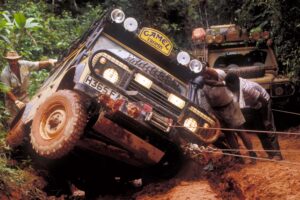
Several years ago, I arrived in Dar es Salaam, Tanzania’s major port and former capital, after more than two days riding the rails on the run-down TAZARA railway from Zambia. A few days later I clambered aboard a long-distance bus bound for Arusha, some 500km to the north. Even though it was still very early, the temperature was already hovering around 25°C and this, together with the ever-present high humidity, made it feel like I was in a Finnish sauna or hothouse.

Once we pulled out of the city, the green landscape along the coast soon gave way to a flat, sun-baked plain carpeted with straw-coloured grasses and dotted with acacia trees. The houses in the small villages that we passed through began to blend into the landscape as the glass and concrete of the city gave way to brown mud. Away from the villages, I could see colourful Masai nomads with their herds of long-horned cattle raising clouds of fine reddish dust into the air. The Masai here are continually on the move in their search for water and grazing in this semi-arid landscape.
As the bus approached Moshi, the so-called gateway to Kilimanjaro, the land began to rise slowly. The sun-drenched plains succumbed to a mosaic of shambas, or smallholdings, where – thanks to higher rainfall and the fertile volcanic soils – the locals eke out a living by growing bananas, maize and coffee.
To the north, I could see Kili rising abruptly above the African savanna. As the sun dipped towards the distant western horizon we rumbled through the streets of Arusha and finally rolled into the bus station. Jumping off the bus was like entering another world. The energy-sapping sticky heat of the coast was now a distant memory!
Instead, because Arusha stands at 1 400m, the air was cool and fresh – at least by African standards. Here daytime highs seldom rise above the mid-20’s and night temperatures regularly fall into single figures. The air was also noticeably drier. Also gone were the hustle and bustle of downtown Dar where pedestrians, buses belching smoke, and motorists continually blaring their horns jostled for space. In contrast, Arusha looked orderly, far less crowded, and more laid back. In all, it had a pleasant ambience.
A two-in-one volcano
The next day a half-hour’s drive landed me in Arusha National Park whose centrepiece is Mount Meru. It is also known today as Socialist Peak – probably so named in remembrance of the socialist policies that Julius Nyerere implemented during his time as the first President of independent Tanzania from 1964 to 1985. Here I met up with my guide, Moses. Dressed out in green army fatigues, a white sunhat and heavy trekking boots, he was to be my sole companion on Meru.

Composed of lava and beds of ash, Meru has a diameter of some 25km and rises 3 000m above the surrounding plains and is one of the world’s largest free-standing mountains. The savanna grasslands soon gave way to Meru’s super-sized crater, or caldera.
I had the pre-conceived idea that a crater only occurs at the summit of a volcano, as on Kili, and can only be reached through an arduous climb. Not on Meru! In recent geological time, some 8 000 years ago, violent eruptions caused the original summit crater to collapse with a mighty bang, producing the huge hole that I was now gazing at. The eruption also caused a collapse of the eastern wall of the original crater and so the caldera today opens out eastwards into the surrounding grasslands. This meant that I could easily see inside the caldera without climbing.
It was, indeed, an unforgettable sight. The giant horseshoe shaped caldera measures 8x5km and the western wall is nearly vertical, soaring 1 500m into the sky.
A later eruption resulted in the formation of a huge ash cone in the caldera which, elsewhere, would be considered a volcano in its own right. Steep-sided, it rises majestically some 1 100m above the caldera floor. It is made up of layers of loose pale brown ash. Meru is certainly unique in East Africa – a two-in-one volcano! And it is still regarded as active since the last eruption occurred in 1910. But thankfully, it is safe to climb today!
Mount Meru is located in a very unstable part of the earth’s crust and is associated with the great East African Rift Valley. The latter extends for some 6 400km from Jordan in the north, through the Red Sea and along the length of East Africa to the mouth of the Zambezi River in Mozambique – the longest crack on the planet. This valley began to develop some 100 million years ago and, unlike most valleys, was not formed by river erosion. Instead, violent earth movements have played a major role in its formation.
About 20 million years ago, movements of the crust along major fissures, or faults, caused the land to drop, thus forming the valley. Since then, magma from the mantle has repeatedly risen upwards along these faults. On reaching the surface, the magma, now known as lava, erupted and formed volcanoes, such as Meru. The oldest rocks on Meru have been dated at 1.5 million years.

Leaving the crater behind, we followed the trail which now steepened and led into the surrounding virgin mountain cloud forest – a silent world of densely packed tall evergreen trees up to 40m high. Here the trees formed an archway, or tunnel, through which we walked ever upwards.
The tree branches were festooned with drooping masses of Spanish moss. This plant does not feed directly off trees. Instead, it is an epiphyte that absorbs nutrients and water through its own leaves from the air and rainwater falling upon it. Occasionally, we caught glimpses of black and white colobus monkeys scampering up and down branches in search of some tasty morsels to eat. Underfoot, and hidden from the sun’s rays, the forest floor was soft and moist and punctuated with small streams along which vivid green mosses clung onto the surface of boulders.
Wildlife encounters
At one point, I asked why Moses was carrying a rifle over his shoulder. “Because there are many wild animals here,” he replied, as if it was nothing unusual to be doing so. Looking around, I could see no danger and surely monkeys would not pose any threat to us humans? During my previous climb of Kili, my guide never carried a firearm and we had seen no game at all. However, shortly afterwards I had to swallow my words. We entered a grass covered clearing in the forest and there they were – a herd of some 20 heavily built, tank-like buffaloes.
They formed an impenetrable line under the trees on the far side of the clearing and without exception, they were all staring intently at us. Clearly, they meant business. With a sinking heart, I realised that two puny humans would be no match against these mean looking behemoths which could so easily charge and gore us with their pointed horns! And they have been known to kill their chief predator – the lion. So, what chance would we have if they decided to go for us? No wonder, then, that hunting websites refer to buffaloes as ‘black death’ because of their dangerous personality, even if they are herbivores and humans do not feature on their menu!
My initial reaction to seeing these beasts was to stop dead in my tracks. Gripped with fear, I was even afraid of getting my camera out of the bag and taking some snaps. It was the first time in my life that I walked in a wildlife area, away from the safety of a vehicle, but I took comfort in knowing that Moses was well prepared for any eventuality. Finally, he gave me the all-clear to continue.
In the late afternoon, Moses declared that it was time to set up camp. Once tents had been set up and we had eaten our fill, it was time for some shut eye. But I still felt a little apprehensive – would we be attacked by some grumpy buffalo bull in the small hours? However, I soon drifted off into dreamland and awoke to see thin streaks of sunlight piercing the forest canopy.

The trek continues
After a quick bite to eat, we were soon back on the trail. The forest finally succumbed to the alpine zone at a height of about 3 000m and now the slopes were covered with open moorland dotted with tree-like giant groundsels which may grow up to five metres tall. At these altitudes, days are warm whilst nights can be bitterly cold.
This means that the range of temperature between day and night is extreme, and plants here have adapted to living in such conditions in many ways. The giant groundsel has adapted by producing large fleshy succulent leaves that are arranged in massive rosettes at the top of the stem. Also, the plant retains withered and dead foliage and this helps to insulate the stem and protect it from the cold. Giant groundsels resemble our familiar aloes, but aloes are much smaller in size and are more common in warmer climates.

Higher up the mountain the groundsels disappeared, and we entered a stark barren moon-like world, silent and lifeless and devoid of all life. All I could hear was the crunch of my boots on the loose unsteady scree. Although the going was now steeper and hard going, I took comfort in the fact that no buffalo could possibly live up here or pay us an unwelcome visit in the middle of the night. The slopes were streaked with narrow gullies in which hardy plants have, against all odds, managed to cling to life. As the afternoon wore on, the sun cast long dark shadows over the mountain, and we decided to set up camp close to the craggy summit.

Waking up the next morning in the early pre-dawn chill, I was rewarded with views over the endless savanna plains dotted with small volcanic lakes. The plains continued to the eastern horizon where I could see distant snow-capped Kili bathed in the early morning light. This ‘Big Daddy’ of African peaks was etched sharply against the clear cobalt blue sky. But somehow it did not seem to be in the same league as Meru. From where I was standing, Kili looked like little more than a small blip on the horizon. But sadly, it was now time to leave this jewel in the sky.
Having reached the summit of both peaks, I would gladly put Meru in the premier league and Kili on the second tier of Africa’s mountain peak league! Whilst I would love to return to Meru, I would probably give its big brother a miss.
I just hope that rampant commercialism does not rear its ugly head over Meru as it has done at Kili! We need to conserve and protect these majestic peaks for future generations.

FACT FILE
Getting there
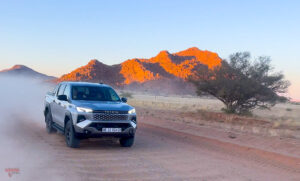
There are indirect flights between Johannesburg and Kilimanjaro International Airport (located between Moshi and Arusha, quite close to Arusha National Park) via Nairobi with Kenya Airways and Precision Air. Ethiopian Airways also flies from Johannesburg to Kilimanjaro via a stopover in Addis Ababa. In addition, there are flights via Dar es Salaam with Airlink and Precision Air. There are daily buses between Dar es Salaam and Arusha (as well as between Nairobi and Arusha).
When to go?
Meru can be climbed at any time of the year. However, if possible, avoid the two rainy seasons, one from March to May and the other around November. At such times, the mountain may be shrouded in cloud and mist for much of the time.
Climbing Mount Meru
Most tour operators in Arusha can arrange guides and porters for your climb up the mountain. Climbing Meru usually takes four days, although it can be done in three. All trekkers take the same route, which begins at Momella Gate, with two overnight spots on the way to the top – Miriakamba Hut (2 541m) and Saddle Hut (3 570m).
Health and safety
Meru is generally malaria-free; however, visitors staying at lower lying Arusha may be more at risk of contracting malaria. So, seek medical advice before leaving home. The sun is strong, even at high altitudes on the mountain, so take sunscreen and lip protection balm. Bottled water is also a must. Although there are well-equipped pharmacies in Arusha, bring what medication you need.
The main health issue that may affect trekkers on the mountain is altitude sickness. This is a condition that is caused by rapid exposure to low amounts of oxygen at high altitude (the amount of oxygen in the air decreases with increase in altitude). Altitude sickness may, for some people, begin to appear at around 2 000m but others might only experience symptoms at much higher altitudes. Many trekkers on Meru may summit without showing any symptoms at all!
The chance of getting altitude sickness does not depend on your level of fitness – a healthy, fit person is just as likely to suffer from this condition as one who is grossly unfit! Altitude sickness can be minimised, or prevented, by ascending slowly and taking deep breaths, or taking time to acclimatise at one of the huts on the route by staying at one hut for two nights instead of one. Fluid intake should also be increased.
Symptoms of mild altitude sickness may include loss of appetite, headaches, vomiting, nausea, tiredness, confusion, trouble sleeping, shortness of breath upon exertion, and dizziness. More severe symptoms include fever, a persistent dry cough, shortness of breath even when resting, increased nausea and vomiting and loss of consciousness. In such cases, the patient must descend immediately to a lower altitude. Always inform your guide if you think you are experiencing symptoms of altitude sickness.
Money
Tanzania’s currency is the Tanzania shilling (1US$ = 2 500 shillings; 1 ZAR = 130 shillings). Foreign currencies, such as the US dollar and Euro, may be exchanged for shillings in Arusha.
Visas
South Africans and other nationals in southern Africa do not need a visa to enter Tanzania as a tourist for a stay of up to 90 days. Your passport should be valid for at least six months from the date of entry.