The Swartberg Pass is for many South Africans the rubicon of gravel road passes. There is an allure and a mystique around this old pass, coupled with its status as a national monument, which elevates this pass to the very top of every adventurer’s list.
Thomas Bain’s final piece of road building, the Swartberg Pass, is very long at 23.8 km and it takes about an hour to drive, excluding stops. You will be treated to a wide variety of incredible scenery, but the pass is not suitable for anyone suffering from acrophobia.
With the quaint town of Prince Albert nearest to the pass, it offers a great day out with plenty to see, from flora to fauna, and some mind-boggling geology. The fynbos is at its best in winter and spring with proteas, ericas, restios and pin-cushions in profusion. The Swartberg Nature Reserve – at 180 000 hectares in size – offers ample activities for the whole family, including hiking, picnicking, 4×4 routes, bird-watching, swimming and just relaxing close to nature.
The Swartberg Pass was the last pass that Thomas Bain built in the Cape and it was surely his opus magnum with the final cost coming in at 14 500 pound sterling, excluding the value of convict labour, which was free. The dry-packed stone walls that you will see along the length of the pass are truly impressive; the handiwork of Bain who was then at the height of his engineering prowess as a road builder.

The moment the kloof is entered from the north, the sunlight is blocked off and the mountains tower vertically up on either side of the road in a dazzling display of contorted sandstone, giving the rocks a blood-red appearance, depending on the time of day.
The most troublesome part of the pass’s construction – as history has it – was at Mullers Kloof. In May 1885 a devastating flood swept across the Swartberg Mountains, washing away most of the road in the adjacent Meiringspoort and causing a long closure. Bain’s brand-new road also suffered damage, but he learned his lessons well and rebuilt the damaged sections of the road further away from the river’s flood levels.
About 4.5km from the northern start, there are some ruins, marked as Blikstasie (Tin Station). These ruins were once home to the convicts who constructed the pass. From the ruins, if you look up the slope to the left of the road, you will get perfect views of the massive retaining walls that support the road ascending up Mullers Kloof. These are the most impressive of all the walls and at places reach a height of 13 metres! This is also the kloof that was featured in the TV commercial with David Kramer, chasing his beloved Volksie Bus up one of the hairpins in his trademark red vellies.
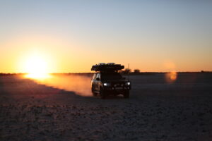
If you get to drive this pass around sunset, this rock face glows a deep and fiery red in the setting sun and has earned itself the nickname of “Wall of Fire” and you are likely to see baboons and klipspringers, the latter of which seem to float up the mountainside with no apparent effort. There are also grey roebuck, leopards and caracal – with the last two seldom being sighted.
Once up on the plateau ridge, the road climbs inexorably towards the view-site known as Teeberg. It’s located at the apex of a very sharp right-hand bend at an altitude of 1 394m, exactly 9km from the northern start. Looking north one gets a majestic view over the 500m deep chasm that runs all the way down to Malvadraai. A little further, some green-roofed buildings appear on the right of the road, almost directly below the pass summit. This was originally the site of the road camp where the convicts were housed and perished one snowy night 120 years ago, when their roof caved in.
At the 1 575m summit be prepared for cold, blustery conditions. A sticker plastered sign announces: DIE TOP. This is not the optimum view site on the pass and the weather often spoils things as the wind can really howl through the neck, often reaching gale force conditions. There are far superior viewpoints further along the descent.
The moment the road curves through the sharp left-hander at the summit, huge views of green fields and distant grey mountains open up. All along the descent, there are wonderful examples of Thomas Bain’s perfectly constructed dry-packed walls.
Cautionary: The Swartberg Pass is popular with both local and international travellers as can be attested by the many hire cars that can be seen on the pass seven days per week. Tourists tend to drift completely onto the wrong side of the road as they take in the grand scenery. Be vigilant, blow your hooter as you enter a blind corner and drive with your headlights on. There are no heavy vehicles or caravans allowed.
Fact file:
- GPS START: S33.282333 E22.052567
- GPS SUMMIT: S33.352335 E22.046130
- GPS END: S33.391758 E22.109058
- AVE GRADIENT: 1:28
- MAX GRADIENT: 1:8
- ELEVATION START: 737m
- ELEVATION SUMMIT: 1 575m
- ELEVATION END: 865m
- HEIGHT GAIN/LOSS: 838m
- DISTANCE: 23.8km
- DIRECTION – TRAVEL: South
- TIME REQUIRED: 60 minutes
- SPEED LIMIT: 40 – 60kph
- SURFACE: Gravel (R328)
*For more information on mountain passes near you, visit the Mountain Passes South Africa website: